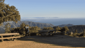
The Old Railroad Grade trail/fire road from Mill Valley to the top of Mount Tamalpais follows the route of the "crookedest railroad in the world," which from 1896 until 1930 hauled tourists on scenic excursions.
Today's rail trail is popular with the Lycra/cyclist crowd as well as with hikers, trail runners and DogTrekkers, so keep your dog leashed to stay out of trouble.
You can hike all or part of the 6.6-mile route, which climbs at a stiff, 8.2-degree grade and gains 1,300 of elevation as it switchbacks up to the East Peak Visitor Center, or make a shorter loop incorporating the Fern Creek or other trails.
Many hike only as far as the West Point Inn, a hikers' retreat and the only complex of buildings remaining from the railroad era (sorry, no dogs allowed on the deck or in buildings).
Carry a leash for your dog; the Blithedale Summit Open Space Preserve of which the trail is part encompasses tracts of land administered by both the Marin County Open Space District, where dogs are allowed off-leash on fire roads; and the Marin Municipal Water District, where leashes are the rule.
• Bring water for you and yours; there are no facilities along the way.
• Dogs are allowed on leash.
Directions: Choose from several trail heads.
• From Highway 1 in Mill Valley, veer right on Panoramic Highway, ascending a few miles to Mountain Home Inn and a parking area. The trail begins across Panoramic Highway. You'll hike a little farther from here than from alternate trail heads, but parking is more assured.
• To get to the scenery more quickly, hike in from the Blithedale Park trailhead (limited parking along the road).
• To reach it from Highway 101 in Mill Valley, take the East Blithedale exit and follow East Blithedale to its intersection with Throckmorton in downtown Mill Valley. Turn right (north) on West Blithedale and wind up through the neighborhoods to the park. Look for the trailhead behind a gate on the right.
• Other trail heads are located off of Ridgecrest Road.


