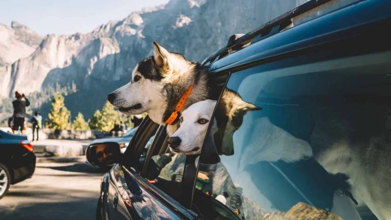
Why hurry to Yosemite National Park when the journey can be as rewarding as the destination? The Yosemite Region encompasses four gateway counties, each with its own unique set of attractions. Here are some of the best places and diversions for DogTrekkers to check out along the major highway corridors leading to the iconic park.
West (Arch Rock) Entrance
Mariposa County, Highway 140
The Highway 140 corridor through Mariposa County offers plenty of dog-friendly fun along its winding way. The gateway communities of Midpines, Mariposa and El Portal, not far from Yosemite’s Arch Rock entrance, are surrounded by public lands and make great base camps for outdoor-oriented DogTrekkers. Campgrounds abound, along with dog-friendly lodging where you and your pup will find a warm welcome at the end of your day.
The Merced River is a recreational magnet in this part of Mariposa County, and one of the best ways to appreciate its wild and scenic beauty is with a hike on the Hite Cove portion of the 18-mile Merced River Trail.
Wildflowers are abundant in season, with some coming into bloom as late as July. Another good paws-to-the-path choice: Briceburg Canyon Trail, where a rail trail starting on the far side of a suspension bridge at the Bureau of Land Management (BLM) visitors center runs for four miles on a hillside above the river along the former route of the Yosemite Valley Railroad.
In Midpines, the family-friendly Yosemite/Mariposa KOA makes a great base camp for do-it-yourselfers. It offers camping cabins as well as RV and tent sites, along with a swimming pool, clubhouse, playground, Merced River fishing access and other amenities on a 30-acre site.
El Portal is a bustling gateway town where many DogTrekkers choose to stay while visiting the park.
A solid and moderately priced choice is Yosemite View Lodge, with rooms overlooking the rushing Merced River. Of course, you may get “The Bug”–Yosemite Bug, that is. This rustic mountain resort is perhaps the most diverse property in the area, offering lodging in new cabins, older cabins with shared bath, tent cabins and even hostel-style dorm rooms. Dogs are welcome in all but the dorm rooms, and attitudes toward canines are extremely relaxed.
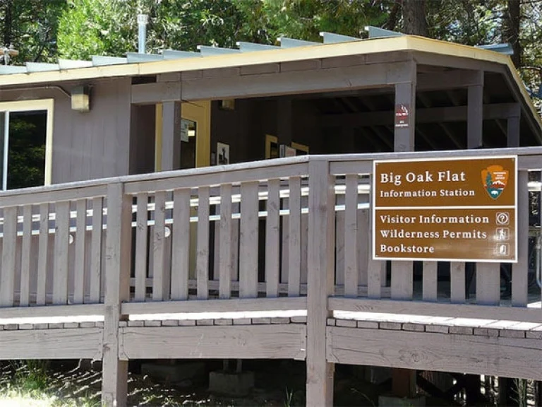
North (Big Oak Flat) Entrance
Tuolumne County, Highway 120
The rugged area known as Big Oak Flat has a history much more colorful than its name. John Savage and his five Native American wives, who opened a trading post near a grand old oak tree that gave the place its name, settled it during the earliest days of the Gold Rush.
Modern Highway 120 through dog-friendly Groveland bypasses the original Big Oak Flat wagon route, but you can still drive a precarious section of the original route, signed Old Priest Grade.
Look for the signs as you approach Groveland; the OPG will reconnect with Highway 120 after a few hair-raising miles. (Note: If your human or canine passengers are prone to carsickness, you might want to skip this scenic detour!)
Travelers coming from Sacramento or the Bay Area have several choices for getting from Highway 99 to Groveland and the Big Oak Flat park entrance. A couple of options:
Highway 132 out of Modesto follows the Tuolumne River gorge to the colorful Gold Rush town of Coulterville. The entire town, from Magnolia Saloon’s bat-wing doors, to the antique shops, artifacts and colorful locals, harks back to the iconic TV Westerns of old.
From Coulterville, head north through Greeley Hill to Smith Station Road and up to Highway 120. This is the recently designated John Muir Highway, which follows the achingly picturesque route the famous naturalist took as he walked from San Francisco to Yosemite in 1868.
The more heavily traveled route to Yosemite is Highway 120 out of Manteca, best known to Highway 99 passers-by as home to an enormous Bass Pro Shop, where you can pick up fishing gear as well as dog supplies for your trip (sorry, no dogs allowed inside).
The road begins its twisty climb into the mountains at Oakdale, where a quick stop at the Visitors Center will yield maps and literature to help guide your trip.
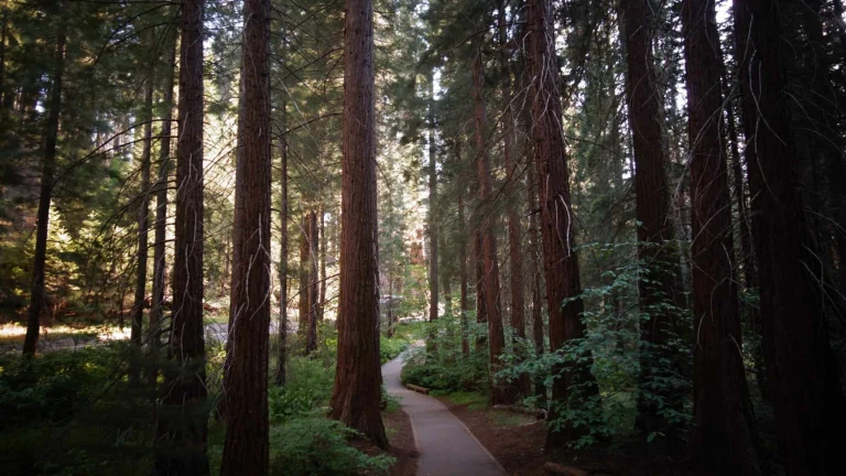
The Stanislaus National Forest surrounding Highway 120 is a recreational wonderland with many day-hike opportunities. If you have four-wheel drive, get a map and make a detour to Trumbull Peak Special Interest Area, where a 45-foot fire lookout tower looms large over the Merced River. On a clear day, the tower offers panoramic views of Yosemite Valley. While we don’t recommend hauling your dog up the stairs, the two of you will enjoy hiking on surrounding trails.
Groveland, where many Yosemite visitors make base camp for forays into the park, is another Gold Rush town worthy of exploration. But if you arrive on a hot afternoon and have energy to spare, keep going.
About 15 miles past the town, on the right-hand side of the road, is Rainbow Falls and Pools, a series of popular and very picturesque swimming holes on the South Fork of the Tuolumne River. A parking lot and restrooms are provided, access is free and your pup is welcome to splash in the pools with you.
At the end of an active day, it’s nice to come home to a hot shower and a soft bed–and the beds don’t get any softer than the “mile high” feather versions at the very dog-friendly Groveland Hotel, whose fine-dining restaurant spills onto a dog-friendly patio.
Offering similar Victorian charm is the Hotel Charlotte, with three pet-friendly rooms and a location right in the center of this highly walkable town.
South (Wawona) Entrance
Madera County, Highway 41
Highway 41, the southern corridor into Yosemite, starts in Fresno and begins its serious climb in Oakhurst, where Queen’s Inn by the River features an adjacent winery, the Idle Hour, and a beer garden where, Wednesdays through Sundays, almost 100 wines and craft beers are available to guests.
Nearby Bass Lake is a recreation magnet and destination in itself for many summer vacationers. Its three primary resort/marinas–The Pines, The Forks and Miller’s Landing–extend a warm welcome to pets with people in tow. All cater to visitors interested in hiking, fishing, water skiing, boating, kayaking or visiting wineries, museums, art galleries, theaters and other attractions in the region.
Smaller properties and campgrounds around the lake offer additional dog-friendly options.
Next town up the road is Fish Camp, where the Yosemite Mountain Sugar Pine Railroad is a family-pleasing attraction offering steam-train excursions through the redwoods along with exhibits, picnic grounds and hiking trails. All but the dinner trains are dog friendly.
Nearby Tenaya Lodge is a luxury property well equipped to serve DogTrekkers with in-room amenities and lots of advice on dog-friendly hiking, dining and other activities in the area. Tenaya and Fish Camp are just two miles from the park’s Wawona entrance.
Ah, Wawona. Of all Yosemite’s hotels, this Victorian confection just inside the Wawona entrance evokes the most yearning for yesteryear. No, it’s not dog-friendly–but it nevertheless is the starting point for the only dirt surface in the entire park where canine hikers are allowed. OK, it’s a fire road, not a trail. Nevertheless, the Wawona Meadow Loop meanders 3.5 miles through the area, offering pretty views, fresh air, great exercise and lots of wildflowers in season.
East (Tioga Road) Entrance
Mono County, Highway 120
Cody, Tioga Pass. Photo by Patti Thompson.
Most travelers entering Yosemite National Park via the Tioga Road will already have filled their eyes with some of California’s most stupendous scenery. This route over the Sierra crest starts at scenic Highway 395, a north-south byway that ranks up there with coastal Highway 1 as California’s most scenic drive.
South of the 395/120 junction, the June Lake and Mammoth Lakes areas hold some of the state’s most stunning and paw-friendly high-altitude scenery. Just north of the junction, Mono Lake, with its distinctive tufa towers and rich bird life, welcomes leashed dogs on most trails, if not on viewing platforms and boardwalks.
At the junction itself, the community of Lee Vining sits at the nexus of an area rich in opportunities for hiking, fishing, photography and bird watching, which is at its peak in fall.
The Whoa Nellie Deli is one of California’s most famous “road food” stops, offering gourmet surprises including buffalo meatloaf, Asian sashimi, “world famous” fish tacos and a generous selection of grab-and-go sandwiches and other picnic treats you can enjoy on the road with your dog at your side.
Once inside Yosemite National Park, hiking opportunities with your dog are limited. That said, dedicated trekkers who plan their time accordingly will find scenery along eastern Highway 120, just outside the park boundary, to rival anything within its borders.
The Twenty Lakes Basin area, part of the Hoover Wilderness, features many scenic paths including the Saddlebag Lake Loop Trail skirting the lake of the same name.
Tioga Road/Highway 120 continues into the park and up, up, up to Tioga Pass at 9,943 feet. It exits 59 miles later at the Big Oak Flat portal in Tuolumne County.
Although dog-friendly options along the route are limited to picnic spots, this is one scenic drive you don’t want to miss. Our suggestion: Pack a picnic and take a roadside break at Tenaya Lake, where you’ll likely be entertained by the sight of stand-up paddle-boarders practicing their sport against a classic alpine backdrop. You’ll have to pay an entrance fee to drive through the park, but considering the pass is good for a week and there are few other routes over the mountains, the fee, in our opinion, is hardly worth growling about.