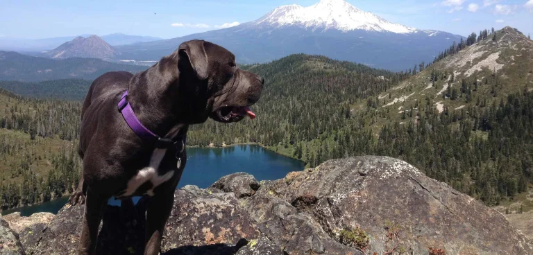
Mount Shasta, an hour north of Redding, is considered by many to be one of the world’s most spiritual “power spots.” Even if you’re not into New Age thinking, you and your furry friend will find higher purpose with a trip up the Everitt Memorial Highway, a two-lane strip of asphalt winding 14 miles up the flanks of the 14,179-foot-high volcanic cone for unforgettable hikes and views.
As the road climbs from Mount Shasta City (elevation 3,500 feet), the vistas to each side become more and more astounding. To the left, Shasta’s icy summit sparkles between stands of conifers and glacier-scoured landscapes. To the right, a succession of mist-filled valleys recedes to infinity. The road ends and the late-summer snow line begins at the 8,000-foot-high site of the now defunct Ski Bowl winter recreation area.

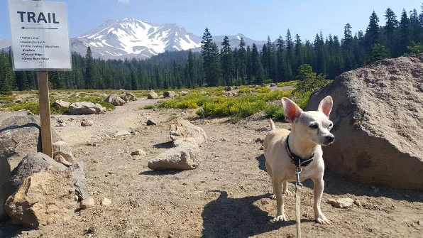
Dogs are allowed anywhere on the network of trails within the Old Ski Bowl ridge line, where even in high summer it’s just a short walk to the snow. Rover is free to roam around (on a leash) at the Bunny Flat and Panther Meadows rest areas, but the only extended hike legal for canine companions is the Gray Butte Trail, a 3.4-mile round trip from the Panther Meadows campground. This very special path, accessible late June into October, crosses a sacred Native American site and takes in otherworldly stands of old-growth fir and mountain hemlocks to reach a saddle with expansive views. At an altitude of 9,129 feet, you’ll both be panting but oh so glad you came. Photo: Picnic On the Flank of Mount Shasta – Janet Fullwood