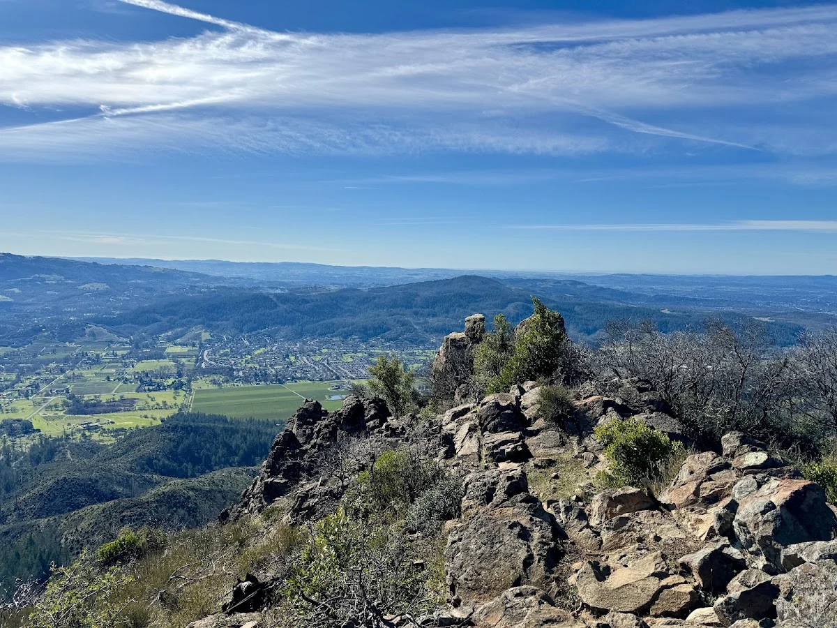
Hood Mountain Regional Park sprawls across 1,750 acres of Sonoma County wilderness—the largest park in the regional system—with over 19 miles of trails cutting through mixed-conifer forests, open meadows, and creek crossings. The hiking here is legitimately challenging, so come prepared for a serious workout with your dog. You’ll gain elevation steadily, but the payoff is real: panoramic views of the Mayacamas Mountains and, when visibility cooperates, sightlines toward Bay Area landmarks.
The summit route culminates at Gunsight Rock, an overlook that justifies the effort. If you want something less intense, the Santa Rosa Creek trail accessed from the Los Alamos Road entrance offers easier terrain suitable for dogs of varying fitness levels. The paths themselves are well-maintained despite their rugged character, which means solid footing even when steep.
Water is the real constraint here. There’s no potable supply at trailheads, so you’ll need to carry enough for both you and your dog—standard practice for Sonoma County hiking anyway. Bring more than you think necessary; the exposed sections get hot, especially in summer.
If you’re interested in staying overnight, Hood Mountain has four environmental campsites positioned about two miles in from the parking areas. These are genuinely primitive—think picnic tables, food lockers, and tent pads with primitive toilets. No running water, no electrical hookups, no creature comforts. It’s the kind of setup where you’re really committing to being in the backcountry, which some people love and others find underwhelming for the effort required to hike in.
Your dog needs to stay leashed throughout the park. This is wildlife habitat—you’ll share the space with deer, mountain lions, and other creatures—so keeping your dog close isn’t just policy, it’s practical safety. Call ahead before visiting to confirm current pet policies and trail conditions, especially if you’re planning a longer outing or overnight camp.